Calculate the gradient of line segments from a 3D matrix of coordinates
Source:R/slopes.R
slope_matrix.RdCalculate the gradient of line segments from a 3D matrix of coordinates
slope_matrix(m, elevations = m[, 3], lonlat = TRUE)

slope_matrix_mean(m, elevations = m[, 3], lonlat = TRUE, directed = FALSE)

slope_matrix_weighted(m, elevations = m[, 3], lonlat = TRUE, directed = FALSE)
Arguments
| m | Matrix containing coordinates and elevations. The matrix should have three columns: x, y, and z, in that order. Typically these correspond to location in the West-East, South-North, and vertical elevation axes respectively. In data with geographic coordinates, Z values are assumed to be in metres. In data with projected coordinates, Z values are assumed to have the same units as the X and Y coordinates. |
|---|---|
| elevations | Elevations in same units as x (assumed to be metres).
Default value: |
| lonlat | Are the coordinates in lon/lat (geographic) coordinates? TRUE by default. |
| directed | Should the value be directed? |
Value
A vector of slope gradients associated with each linear element
(each line between consecutive vertices) associated with linear features.
Returned values for slope_matrix_mean() and
slope_matrix_weighted() are summary statistics for all
linear elements in the linestring.
The output value is a proportion representing the change in elevation
for a given change in horizontal movement along the linestring.
0.02, for example, represents a low gradient of 2% while 0.08 represents
a steep gradient of 8%.
Examples
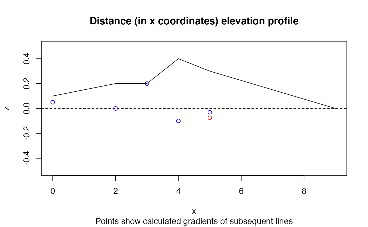
x = c(0, 2, 3, 4, 5, 9) y = c(0, 0, 0, 0, 0, 9) z = c(1, 2, 2, 4, 3, 0) / 10 m = cbind(x, y, z) slope_matrix_weighted(m, lonlat = FALSE)#> [1] 0.04714167slope_matrix_weighted(m, lonlat = FALSE, directed = TRUE)#> [1] -0.04714167# 0 value returned if no change in elevation: slope_matrix_weighted(m,lonlat = FALSE, directed = TRUE, elevations = c(1, 2, 2, 4, 3, 1))#> [1] 0slope_matrix_mean(m, lonlat = FALSE)#> [1] 0.07609208slope_matrix_mean(m, lonlat = FALSE, directed = TRUE)#> [1] -0.07609208#> [1] 0.050 0.000 0.200 -0.100 -0.075(gxy = slope_matrix(m, lonlat = FALSE))#> [1] 0.05000000 0.00000000 0.20000000 -0.10000000 -0.03046038title("Distance (in x coordinates) elevation profile", sub = "Points show calculated gradients of subsequent lines")
