![[Stable]](figures/lifecycle-stable.svg) This function obtains the information about of an eLTER
dataset (e.g.
https://deims.org/dataset/38d604ef-decb-4d67-8ac3-cc843d10d3ef)
provided in DEIMS-SDR catalogue.
This function obtains the information about of an eLTER
dataset (e.g.
https://deims.org/dataset/38d604ef-decb-4d67-8ac3-cc843d10d3ef)
provided in DEIMS-SDR catalogue.
Arguments
- datasetid
A
character. It is the DEIMS ID of dataset make from DEIMS-SDR website. DEIMS ID information here. The DEIMS ID of dataset is the URL for the dataset page.- show_map
A
boolean. If TRUE a Leaflet map with occurrences is shown. Default FALSE.
Value
The output of the function is a list with two elements:
mapA Leaflet map with the dataset location, if requested withshow_map.dataAdata.framewith the information about the dataset.
Author
Alessandro Oggioni, phD (2020) oggioni.a@irea.cnr.it
Examples
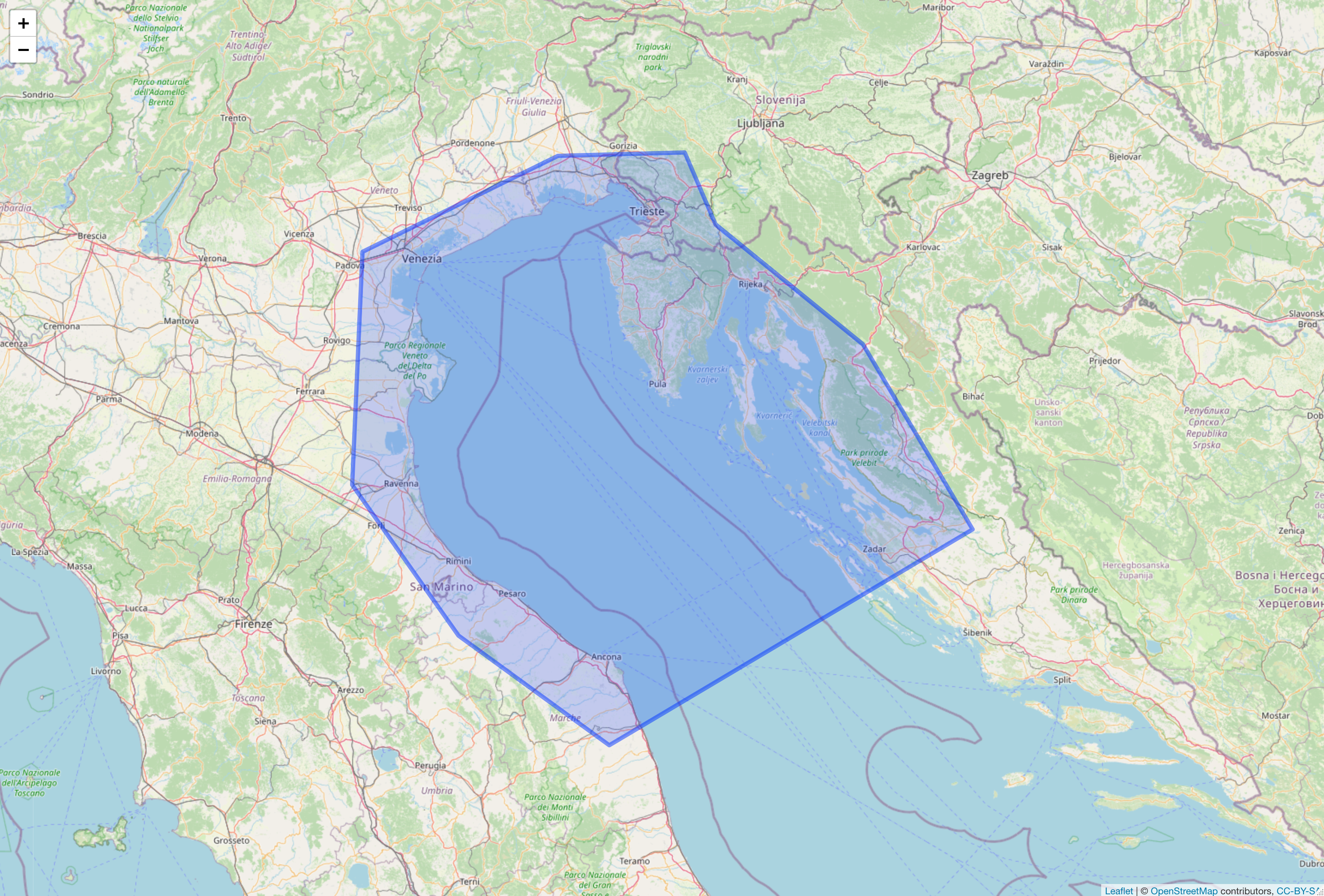
tDataset <- get_dataset_info(
  datasetid =
  "https://deims.org/dataset/38d604ef-decb-4d67-8ac3-cc843d10d3ef",
  show_map = TRUE
)
tDataset
#> $map
#>
#> $data
#> Simple feature collection with 1 feature and 40 fields
#> Geometry type: POLYGON
#> Dimension:     XY
#> Bounding box:  xmin: 11.88721 ymin: 43.20518 xmax: 15.86426 ymax: 45.91294
#> Geodetic CRS:  WGS 84
#> # A tibble: 1 × 41
#>   title    abstract keywords uri   type  created             changed
#> * <chr>    <chr>    <list>   <chr> <chr> <dttm>              <dttm>
#> 1 LTER No… The pre… <df>     http… data… 2019-04-18 15:45:48 2021-06-07 10:40:19
#> # ℹ 34 more variables: dateRange.from <date>, dateRange.to <date>,
#> #   relatedSite <list>, contacts.corresponding <list>, contacts.creator <list>,
#> #   contacts.metadataProvider <lgl>, observationParameters <list>,
#> #   observationSpecies <list>, dataPolicy <list>, doi <chr>,
#> #   onlineDistribution.dataPolicyUrl <list>, onlineDistribution.doi <chr>,
#> #   onlineDistribution.onlineLocation <list>, legal.accessUse <list>,
#> #   legal.rights <lgl>, legal.legalAct <lgl>, legal.citation <lgl>, …
#>