getlandsat tutorial
for v0.1.0
getlandsat provides access to Landsat https://landsat.usgs.gov 8 metadata and images hosted on AWS S3 at https://aws.amazon.com/public-data-sets/landsat. The package only fetches data. It does not attempt to aid users in downstream usage, but some additional functionality may be added.
Potential users are probably anyone from scientists asking questions about biodiversity or land use change, to software developers creating tools for users to vizualize their data.
## Installation
Stable version from CRAN
```r
install.packages("getlandsat")
```
Development version from GitHub
```r
if (!require("devtools")) install.packages("devtools")
devtools::install_github("ropenscilabs/getlandsat")
```
```r
library("getlandsat")
```
## Usage
### List scenes
```r
(res <- lsat_scenes(n_max = 10))
#> # A tibble: 10 × 11
#> entityId acquisitionDate cloudCover processingLevel
#>
#> 1 LC80101172015002LGN00 2015-01-02 15:49:05 80.81 L1GT
#> 2 LC80260392015002LGN00 2015-01-02 16:56:51 90.84 L1GT
#> 3 LC82270742015002LGN00 2015-01-02 13:53:02 83.44 L1GT
#> 4 LC82270732015002LGN00 2015-01-02 13:52:38 52.29 L1T
#> 5 LC82270622015002LGN00 2015-01-02 13:48:14 38.85 L1T
#> 6 LC82111152015002LGN00 2015-01-02 12:30:31 22.93 L1GT
#> 7 LC81791202015002LGN00 2015-01-02 09:14:45 7.67 L1GT
#> 8 LC82111112015002LGN00 2015-01-02 12:28:55 43.43 L1GT
#> 9 LC81950292015002LGN00 2015-01-02 10:17:20 21.02 L1T
#> 10 LC81790452015002LGN00 2015-01-02 08:44:49 1.92 L1T
#> # ... with 7 more variables: path , row , min_lat ,
#> # min_lon , max_lat , max_lon , download_url
```
### List scene files
```r
lsat_scene_files(x = res$download_url[1])
#> file size
#> 1 LC80101172015002LGN00_B4.TIF.ovr 7.7MB
#> 2 LC80101172015002LGN00_B11.TIF.ovr 17.0KB
#> 3 LC80101172015002LGN00_B5.TIF 56.8MB
#> 4 LC80101172015002LGN00_BQA.TIF 2.7MB
#> 5 LC80101172015002LGN00_MTL.txt 7.5KB
#> 6 LC80101172015002LGN00_B5.TIF.ovr 7.8MB
#> 7 LC80101172015002LGN00_B2.TIF.ovr 7.5MB
#> 8 LC80101172015002LGN00_B1.TIF.ovr 7.5MB
#> 9 LC80101172015002LGN00_B7.TIF.ovr 7.9MB
#> 10 LC80101172015002LGN00_B4.TIF 55.4MB
#> 11 LC80101172015002LGN00_B8.TIF 212.3MB
#> 12 LC80101172015002LGN00_B3.TIF.ovr 7.6MB
#> 13 LC80101172015002LGN00_B3.TIF 54.4MB
#> 14 LC80101172015002LGN00_B2.TIF 54.0MB
#> 15 LC80101172015002LGN00_B10.TIF.ovr 17.0KB
#> 16 LC80101172015002LGN00_B6.TIF.ovr 7.9MB
#> 17 LC80101172015002LGN00_B9.TIF.ovr 7.0MB
#> 18 LC80101172015002LGN00_B11.TIF 0.1MB
#> 19 LC80101172015002LGN00_B8.TIF.ovr 29.0MB
#> 20 LC80101172015002LGN00_B1.TIF 54.2MB
#> 21 LC80101172015002LGN00_B10.TIF 0.1MB
#> 22 LC80101172015002LGN00_B6.TIF 58.0MB
#> 23 LC80101172015002LGN00_BQA.TIF.ovr 0.6MB
#> 24 LC80101172015002LGN00_B7.TIF 58.0MB
#> 25 LC80101172015002LGN00_B9.TIF 49.6MB
```
### Get an image
Returns path to the image
```r
lsat_image(x = "LC80101172015002LGN00_B5.TIF")
#> [1] "/Users/sacmac/Library/Caches/landsat-pds/L8/010/117/LC80101172015002LGN00/LC80101172015002LGN00_B5.TIF"
```
Another one
```r
lsat_image("LC80010032014272LGN00_B10.TIF")
#> [1] "/Users/sacmac/Library/Caches/landsat-pds/L8/001/003/LC80010032014272LGN00/LC80010032014272LGN00_B10.TIF"
```
#### Caching
When requesting an image, we first check if you already have that image. If you do,
we return the path to the file. If not, we get the image, and return the file path.
```r
lsat_image(x = "LC80101172015002LGN00_B5.TIF")
#> File in cache
#> [1] "/Users/sacmac/Library/Caches/landsat-pds/L8/010/117/LC80101172015002LGN00/LC80101172015002LGN00_B5.TIF"
```
Note the message given.
See `?lsat_cache` for cache management functions.
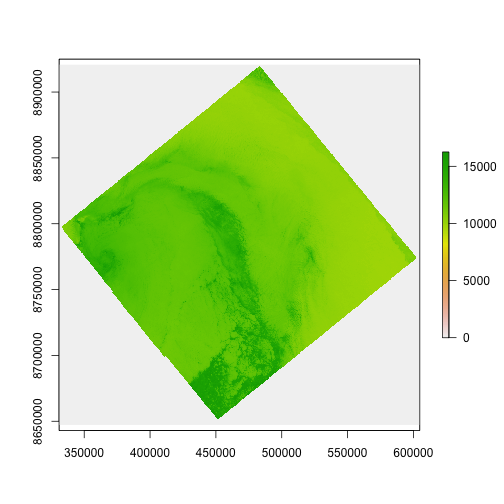
### Visualize
```r
library("raster")
x <- lsat_cache_details()
img <- raster(x[[1]]$file)
plot(img)
```
## Citing
> Scott Chamberlain (2016). getlandsat: Get Landsat 8 Data
from Amazon Pulic Data Sets. R package version 0.1.0.
https://cran.rstudio.com/package=getlandsat
## License and bugs
* License: [MIT](http://opensource.org/licenses/MIT)
* Report bugs at [our GitHub repo for getlandsat](https://github.com/ropenscilabs/getlandsat/issues?state=open)
[Back to top](#top)
